SHEMYA, ALEUTIAN ISLANDS, AK
The “Black Pearl” of the Aleutians
Until 1995, if you happened to be in the U. S. military, worked for the U.S.
government, or were a DoD contractor, you could have won an all expense paid
vacation to Shemya, Alaska. This would include round trip air fare, shelter, and
three square meals a day thrown in for good measure. Shemya is located near
the western end of the Aleutian chain, 1,259.2 nautical miles away from
Anchorage, Alaska (see map). The island of Attu is 34.8 nautical miles NW from
Shemya, while Agattu is just off to the west and can be seen from Shemya on a
clear day. On March 31st, 1995, after 50 years of being a haven for U.S. military
and military support personnel, Shemya was turned over to caretaker status to
be operated by the DoD contractor firm PMC. The Island is now a strategic
refueling stop for military aircraft as well as link in the United State's long-range
early warning radar system.
Active duty military personnel would receive anywhere from a 1-year remote
duty assignment on the Rock to a 4 year tour in Anchorage with frequent visits
to the Rock, while contractor personnel would receive varying length
assignments, usually no longer than a year. This of course, was the scenario after
the war. The Japanese occupied Attu island as well as several others in the
Aleutian chain during WWII. For an interesting read, check out the book titled
"The Thousand Mile War: World War II in Alaska and the Aleutians" by Brian
Garfield. It appears that more men and equipment were lost to mother nature's
rage than to the physical fighting between warring sides!
While cruising the 'net one day, I wondered if some obscure place like Shemya
would have a web page...certainly the folks on the Island would have adequate
time on their hands to do something creative like a web page...and cranked up
the search engines to see what was available. Sure enough, true to form, the web
offered up several hits on "Shemya," however, none originated from the Island.
To help fill the void, I created this web site in 1996. To see a collection of pictures
of post-war life on Shemya, click on the "Post-WWII" menu link above. Click on
the "WWII" menu link to see how folks lived during the war, and visit the Shemya
Mailbag menu link under “Features.” The "Links" menu item will take you to both
internal and external links to pertinent Shemya info. To learn a little history of
Shemya, click on the "book" icons below. If you missed the ominous clouds over
the picture of Shemya at the top of the page, click on it and you can see the
weather Shemya’s experiencing. Oh, by the way, if you've got a sound card, turn
up the volume and listen to the waves...sounds like the northwestern side of the
island during high seas...hear the rocks rolling around?
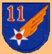
Badges, Patches, and Symbols of Shemya, AK


Last Site Update: 08/05/2022 09:20
Last Page Update: 07/23/2022 06:37
Online Since: 1996
Site Version: Site Version: Aleutians-Shemya-20220805-0741_XaraV19


MAIN Page


SHEMYA, ALEUTIAN ISLANDS, AK
The “Black Pearl” of the Aleutians
 Weather
Until 1995, if you happened to be in the U. S. military,
worked for the U.S. government, or were a DoD
contractor, you could have won an all expense paid
vacation to Shemya, Alaska. This would include round
trip air fare, shelter, and three square meals a day
thrown in for good measure. Shemya is located near the
western end of the Aleutian chain, 1,259.2 nautical
miles away from Anchorage, Alaska (see map). The
island of Attu is 34.8 nautical miles NW from Shemya,
while Agattu is just off to the west and can be seen
from Shemya on a clear day. On March 31st, 1995, after
50 years of being a haven for U.S. military and military
support personnel, Shemya was turned over to
caretaker status to be operated by the DoD contractor
firm PMC. The Island is now a strategic refueling stop
for military aircraft as well as link in the United State's
long-range early warning radar system.
Active duty military personnel would receive anywhere
from a 1-year remote duty assignment on the Rock to a
4 year tour in Anchorage with frequent visits to the
Rock, while contractor personnel would receive varying
length assignments, usually no longer than a year. This
of course, was the scenario after the war. The Japanese
occupied Attu island as well as several others in the
Aleutian chain during WWII. For an interesting read,
check out the book titled "The Thousand Mile War:
World War II in Alaska and the Aleutians" by Brian
Garfield. It appears that more men and equipment
were lost to mother nature's rage than to the physical
fighting between warring sides!
While cruising the 'net one day, I wondered if some
obscure place like Shemya would have a web
page...certainly the folks on the Island would have
adequate time on their hands to do something creative
like a web page...and cranked up the search engines to
see what was available. Sure enough, true to form, the
web offered up several hits on "Shemya," however,
none originated from the Island. To help fill the void, I
created this web site in 1996. To see a collection of
pictures of post-war life on Shemya, click on the "Post-
WWII" menu link above. Click on the "WWII" menu link
to see how folks lived during the war, and visit the
Shemya Mailbag menu link under “Features.” The
"Links" menu item will take you to both internal and
external links to pertinent Shemya info. To learn a little
history of Shemya, click on the "book" icons below. If
you missed the ominous clouds over the picture of
Shemya at the top of the page, click on it and you can
see the weather Shemya’s experiencing. Oh, by the way,
if you've got a sound card, turn up the volume and
listen to the waves...sounds like the northwestern side
of the island during high seas...hear the rocks rolling
around?
Badges, Patches, and Symbols of Shemya, AK


Mobile Page


Last Site Update: 08/05/2022 09:20
Last Page Update: 07/23/2022 06:37
Online Since: 1996
Site Version: Aleutians-Shemya-20220805-0741_XaraV19


